


Magnolia Twp. Voting District, Rock County, Minnesota
About
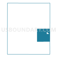
Outline

Summary
| Unique Area Identifier | 604103 |
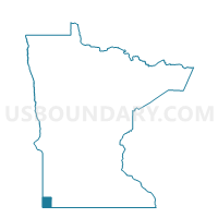
| Name | Magnolia Twp. Voting District |
| County | Rock County |
| State | Minnesota |
| Area (square miles) | 35.24 |
| Land Area (square miles) | 35.24 |
| Water Area (square miles) | 0.00 |
| % of Land Area | 100.00 |
| % of Water Area | 0.00 |
| Latitude of the Internal Point | 43.63044810 |
| Longtitude of the Internal Point | -96.11407900 |
Maps

Graphs
Select a template below for downloading or customizing gragh for Magnolia Twp. Voting District, Rock County, Minnesota


Neighbors
Neighoring Voting District (by Name) Neighboring Voting District on the Map
- Clinton Twp. Voting District, Rock County, MN
- Kanaranzi Twp. Voting District, Rock County, MN
- Lismore Twp. Voting District, Nobles County, MN
- Luverne Twp. P-1, Rock County, MN
- Luverne Twp. P-2, Rock County, MN
- Magnolia City Voting District, Rock County, MN
- Mound Twp. Voting District, Rock County, MN
- Vienna Twp. Voting District, Rock County, MN
- Westside Twp. Voting District, Nobles County, MN
Top 10 Neighboring County Subdivision (by Population) Neighboring County Subdivision on the Map
- Luverne township, Rock County, MN (479)
- Clinton township, Rock County, MN (277)
- Mound township, Rock County, MN (252)
- Kanaranzi township, Rock County, MN (247)
- Magnolia city, Rock County, MN (222)
- Westside township, Nobles County, MN (218)
- Magnolia township, Rock County, MN (212)
- Lismore township, Nobles County, MN (175)
- Vienna township, Rock County, MN (156)
Top 10 Neighboring Place (by Population) Neighboring Place on the Map
Top 10 Neighboring Unified School District (by Population) Neighboring Unified School District on the Map
Top 10 Neighboring State Legislative District Lower Chamber (by Population) Neighboring State Legislative District Lower Chamber on the Map
Top 10 Neighboring State Legislative District Upper Chamber (by Population) Neighboring State Legislative District Upper Chamber on the Map
Top 10 Neighboring 111th Congressional District (by Population) Neighboring 111th Congressional District on the Map
Top 10 Neighboring Census Tract (by Population) Neighboring Census Tract on the Map
- Census Tract 5703, Rock County, MN (3,232)
- Census Tract 1052, Nobles County, MN (3,165)
- Census Tract 5701, Rock County, MN (2,490)